

I recently found an old (1943) map of Papua New Guinea and the surrounding area. I bought it, mounted it, and framed it, and now it’s on the wall in our living room. It sounds simple, but I’m very excited about and proud of it.
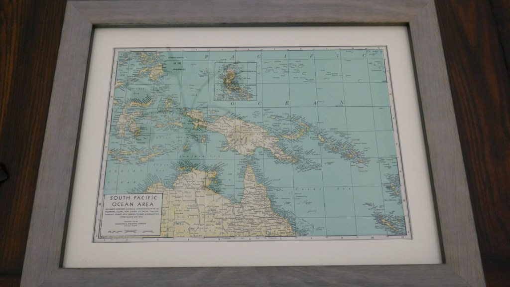
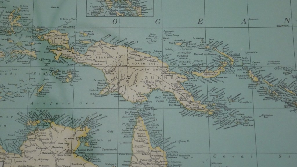
If you look closely at the map, a bit of explanation is in order, since Papua New Guinea is not actually on this map. The island of New Guinea originally contained three colonies. The western half of the island was a Dutch colony known as Netherlands New Guinea (today part of Indonesia). On the eastern side (today’s Papua New Guinea), the northern half was claimed by Germany and named German New Guinea (or Kaiser-Wilhelmsland) and the southern half was claimed by the United Kingdom and named British New Guinea. In 1905 British New Guinea was renamed the Territory of Papua. After World War I, the League of Nations granted the German colony to Australia as the Territory of New Guinea. While Australia also governed the Territory of Papua, it still technically belonged to the UK.
After World War II, the territories of Papua and New Guinea were combined into the Territory of Papua and New Guinea, and later became Papua New Guinea. Since this map was made before the end of the war, you can see the three separate territories still marked on it. The western side is labeled Dutch Territory, the former German colony is labeled North East New Guinea, and the former UK colony is labeled Papua.
Papua New Guinea established its independence from Australia as a sovereign nation on September 16, 1975. They have maintained their status as a commonwealth nation, so they still view Queen Elizabeth II as their head of state. They also still have close ties to Australia as well.

Thanks for the history lesson. I was wondering….
Debbie
LikeLike